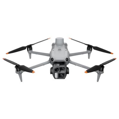
DJI Mavic 3 Multispectral Drone
DJI Mavic 3 Multispectral: See the Unseen in Precision Agriculture
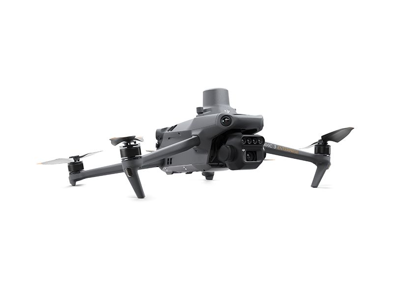
Unlock a new dimension of aerial intelligence with the DJI Mavic 3 Multispectral (Mavic 3M). This powerful, all-in-one drone is engineered to scan and analyze crop health with unparalleled clarity by capturing light invisible to the human eye. By integrating both a high-resolution RGB camera and a four-band multispectral camera, the Mavic 3M delivers the precise, actionable data essential for modern agriculture management.
Built on the celebrated compact and foldable design of the Mavic 3 series, the Mavic 3M is ready to deploy in seconds. It is the definitive tool for agricultural professionals, working seamlessly alongside equipment like the DJI Agras T30 and T40 to guide intelligent, targeted action.
Key Advancements:
- Dual-Vision Imaging: Combines a 4/3" CMOS 20MP RGB camera with a four-sensor multispectral camera (Green, Red, Red Edge, Near-Infrared).
- Built-in Sunlight Sensor: Captures solar irradiance for more accurate and consistent NDVI data over time.
- Precision Positioning: An integrated RTK module delivers centimeter-level accuracy for high-precision mapping without ground control points.
- Extended Flight Time: Accomplish more with up to 43 minutes of flight time on a single battery.
- Advanced Safety: Fly with confidence thanks to Omnidirectional Obstacle Avoidance and Terrain-Follow capabilities.
- Robust Transmission: DJI O3 Enterprise ensures a stable, long-range HD video feed up to 15 km.
Integrated System for Actionable Insights
The Mavic 3M’s power lies in its integrated imaging system. The 20MP RGB camera provides vital visual context, while the multispectral sensors capture specific light bands to reveal critical information about plant health, water stress, and growth stages. A built-in sunlight sensor records solar irradiance, automatically calibrating your data for temporal accuracy and resulting in more reliable NDVI vegetation indices.
Optimized for Performance and Precision
Achieve survey-grade results with the included RTK module, which syncs with the camera system in microseconds to provide centimeter-level positional data for every image. This precision, combined with 43 minutes of flight time and intelligent features like Terrain-Follow for sloped landscapes, makes data collection safer and more efficient than ever.
Intelligent Agriculture and Environmental Monitoring
The Mavic 3M transforms data into decisions. Use it for automated field scouting to find abnormalities like weed pressure or crop lodging in real-time. Paired with the DJI SmartFarm Platform or DJI Terra, you can:
- Reconstruct high-resolution orchard maps.
- Automatically identify and count trees.
- Generate 3D operation routes for agricultural drones.
Beyond the farm, the Mavic 3M is a powerful tool for environmental surveys, including water enrichment monitoring, forest distribution analysis, and urban green area surveys.
