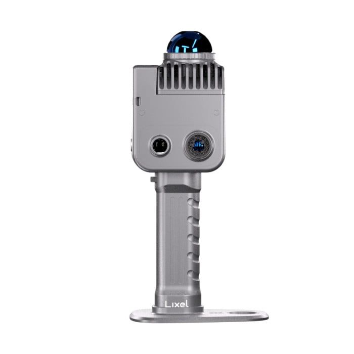
XGRIDS - Handheld Scanners
XGRIDS: A Technical Overview of 3D Spatial Intelligence Solutions
XGRIDS is a technology firm specialising in the development and deployment of advanced 3D spatial intelligence solutions. The company's portfolio integrates proprietary hardware and software to deliver high-fidelity, real-time 3D content generation and spatial computing capabilities across a range of industries.
Core Technological Capabilities:
3D Content Generation: XGRIDS' core technology for 3D content generation leverages a sophisticated fusion of Simultaneous Localization and Mapping (SLAM) and 3D Gaussian Splatting (3DGS). Their proprietary Multi-SLAM algorithm enables robust and accurate real-time 3D reconstruction of large-scale and complex environments. This is complemented by their 3DGS technology, which facilitates the creation of photorealistic, editable, and efficiently renderable 3D models. This approach moves beyond traditional point cloud and mesh-based workflows to produce dimensionally accurate and visually rich digital twins.
Spatial Computing: The company's focus on spatial computing is embodied in its software platforms, Lixel CyberColor and LixelStudio. These platforms provide a comprehensive suite of tools for processing and interacting with spatial data. LixelStudio functions as an all-in-one point cloud processing software, offering features such as automated data processing, map fusion of multiple scans, and industry-specific plugins. Lixel CyberColor is engineered for the creation and rendering of large-scale, ultra-realistic 3D environments, supporting real-time visualization and interaction.
Integrated Hardware and Software Ecosystem: XGRIDS offers a vertically integrated solution encompassing both hardware and software. Their hardware line includes handheld 3D scanners such as the LixelKity K1 and the Lixel L2 Pro. These devices are equipped with high-resolution LiDAR sensors, panoramic cameras, and integrated inertial measurement units (IMUs) to capture precise geometric and photometric data. For example, the LixelKity K1 features a 360° LiDAR with a range of up to 70 meters and dual 48MP cameras, achieving a relative accuracy of 1.2cm. This hardware is seamlessly integrated with their software for a streamlined data capture to model generation workflow.
Strategic Alliances and Market Deployment:
Industry Applications: The application of XGRIDS' technology is extensive and tailored to the specific demands of various sectors. In the Architecture, Engineering, and Construction (AEC) industry, their solutions, including a notable 3DGS Scan-to-BIM plugin for Autodesk Revit, facilitate as-built verification, construction progress monitoring, and digital twinning. Furthermore, their technology is utilized in heritage preservation for the detailed digital archiving of cultural sites, in public safety for forensic scene mapping, and in the digital entertainment industry for the creation of immersive virtual environments.
Collaborative Partnerships: XGRIDS actively forms strategic partnerships to enhance its technological offerings and market penetration. A significant collaboration with Unity China and OneSight AR has been established to develop integrated solutions for smart engineering management, combining 3D visualization with augmented reality. These collaborations are pivotal to their strategy of expanding the application of their spatial intelligence technologies into new and existing markets.
